Principal Consultant: Christopher Macdonald Hewitt. I am a published professional cartographer and data analyst with over 10 years of experience using ArcGIS, QGIS, GeoDa, Python, R and SAS in a broad range of settings. Rates in CAD are negotiated per contract.
Services include:
- Accessing Canadian GIS data.
- Spatial Analysis / Spatial Statistics.
- Cartographic Modeling.
- Cartographic Outputs.
- Creating ArcGIS Online web apps.
Statistics and Data Visualization
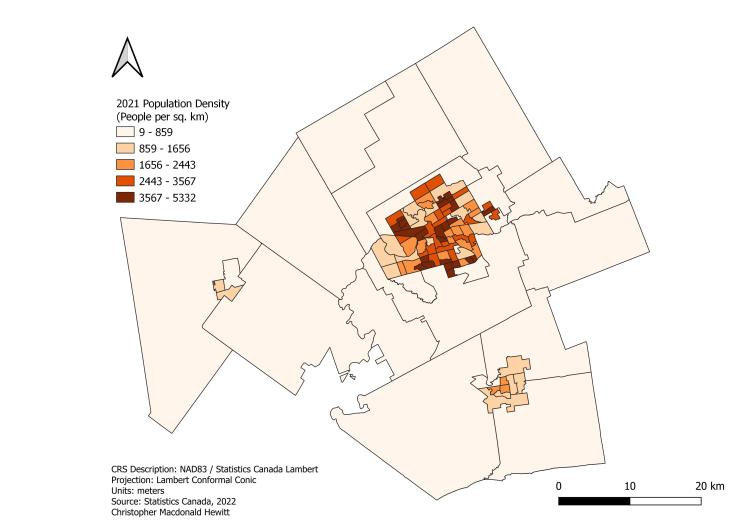
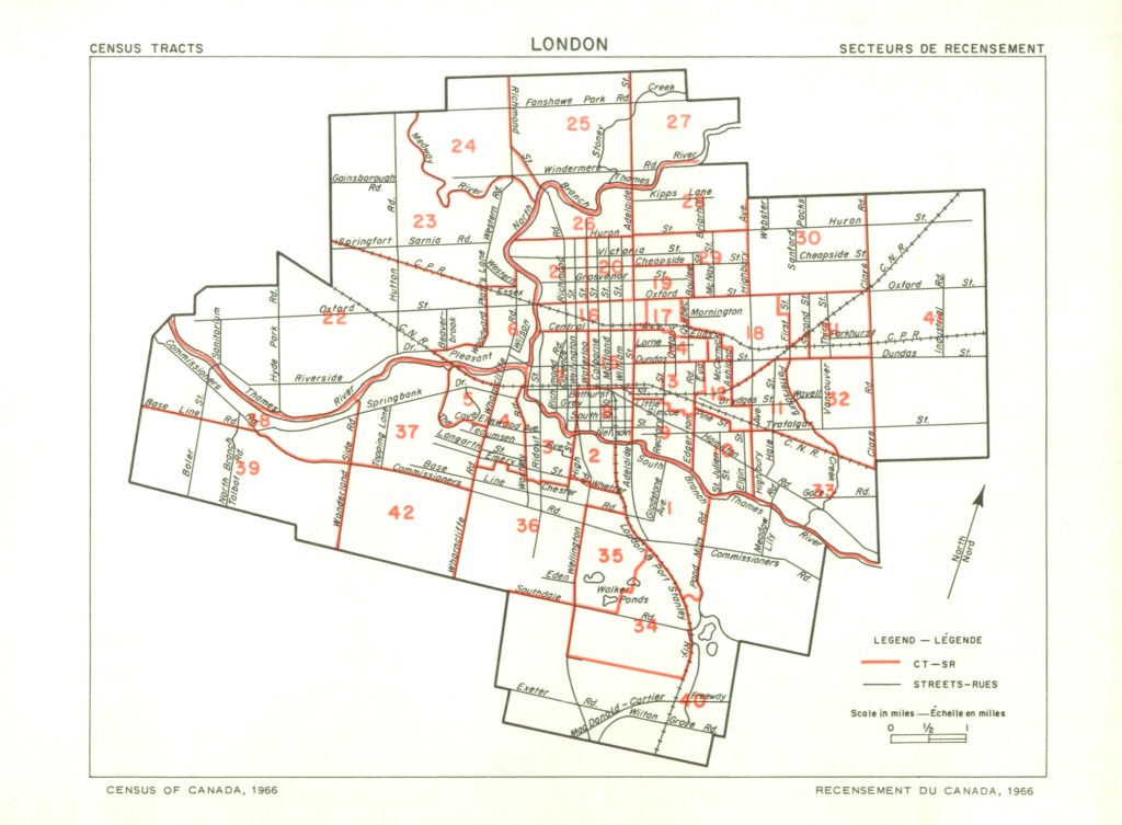
Research using contemporary and historical Canadian census data.
– Explored demographic characteristics using 2016 census data.
– Creating GIS files for Canadian census tracts from 1966 to 1956.
– Visualize Canadian census data back to 1951 with a web dashboard.
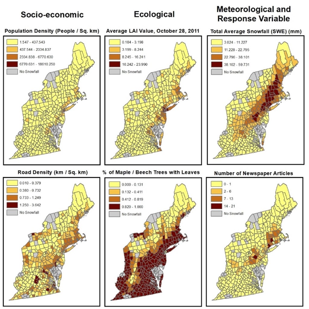
Contemporary Human-Environment Interactions
Research on contemporary issues related to Human-Environment interactions.
– Exploring the ecological and socio-economic impacts of the October 2011 Snowstorm in New England.
– Possibility for investigating other events in the future.
– Published in Ecology & Society.
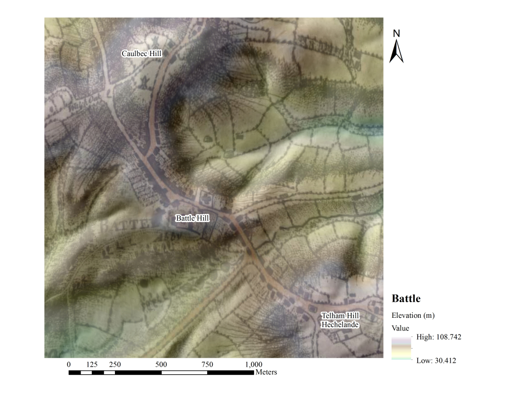
Historical Human-Environment Interactions
Research on historical topics related to Human-Environment interactions.
– Medieval warfare from a geographic perspective using geographic sources and techniques.
– Focus on the Battle of Hastings (1066) but ideas for other battles / campaigns.
My Google Scholar page here lists my articles.
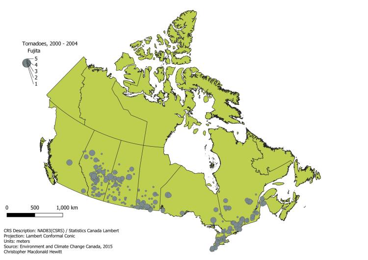
Consultant Cartographer
Published maps in a number of venues on Brazil, British Columbia, Canada in 1921, Medieval England, 1930’s Germany, and Kenya.
Workbooks
Canadian Government GIS Data: For Professionals and the Public
Workshops
Exploring Canadian Geospatial Data with GeoPandas in Colab Notebooks
Python Code
Teaching
Introductory human geography
Introductory geospatial technologies / cartography
Introductory navigation / GPS use
Advanced statistics / research design
Advanced GIS and Remote Sensing


